


Aerial Data. Grounded Decisions
Our Services
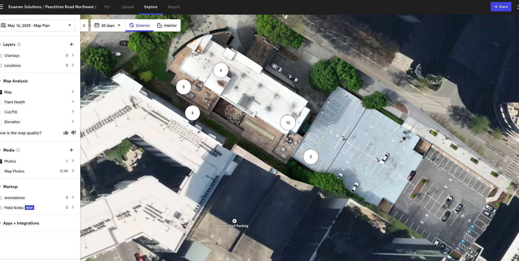
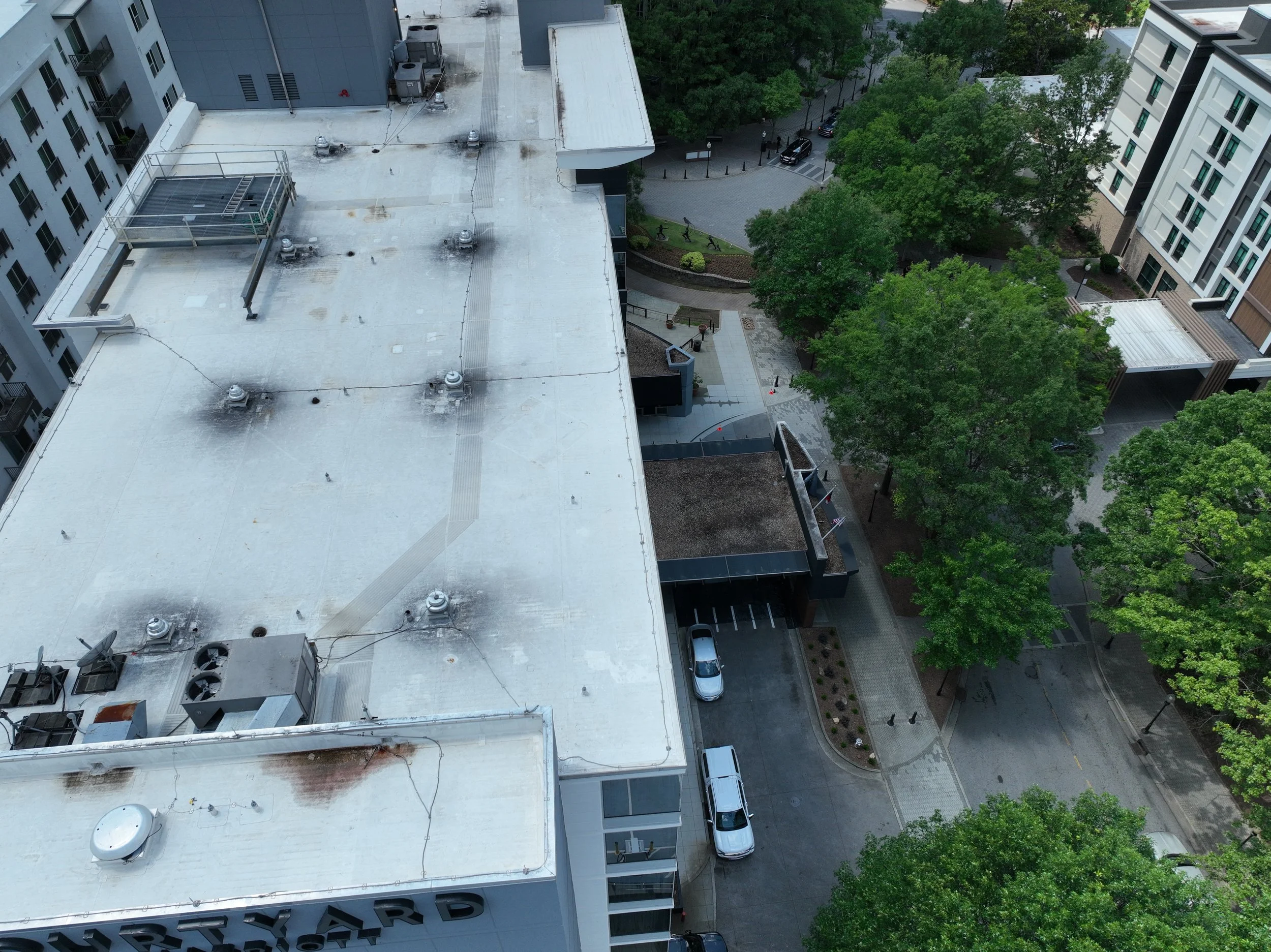
🏠 Roofing & Building Inspections
Aerial roof assessments (residential & commercial)
Hail, wind, and storm damage documentation
Insurance claim support with annotated photo reports
Real estate pre-listing documentation
🏗️ Construction & Engineering Support
Pre-site surveys and progress documentation
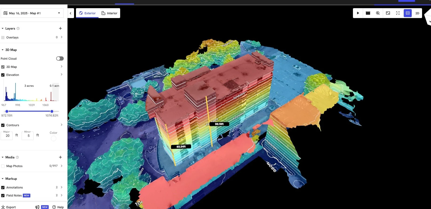
2D orthomosaic maps and elevation models
Cut/fill analysis and grading verification
Volumetric measurements (stockpiles, excavation)
As-built visual records
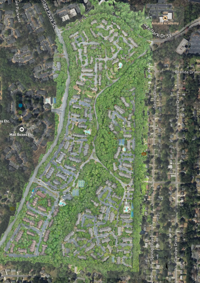
🌐 GIS Mapping & Modeling
High-resolution orthomosaic mapping
3D modeling (mesh, point cloud, textured surface)
Topographic mapping with contour generation
Property boundary overlays and site planning
Data exports for CAD, GIS, and BIM platforms
🔍 Specialty Inspections
Facade and envelope inspections
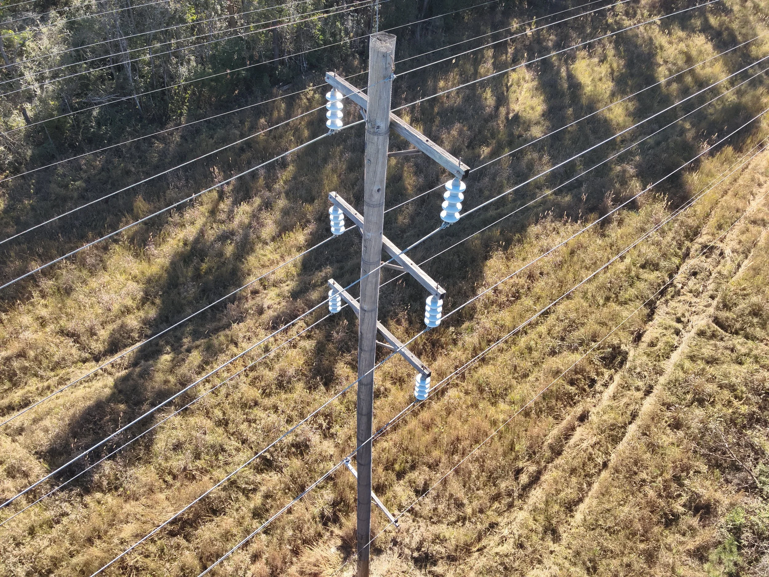
Utility and infrastructure mapping
Site risk and safety analysis
🛫 Operational Standards & Compliance
FAA Part 107 certified pilots
RTK-enabled flights for survey-grade accuracy
Fully insured for commercial drone operations
Secure data handling and reporting
📸 Media Production & Content Creation
All media creation and content is created under JC Digital Media Agency.
Processing
Reports and Annotations
Here are just a few examples of how we take raw drone data and transform it into actionable insights—helping you make informed decisions with confidence.


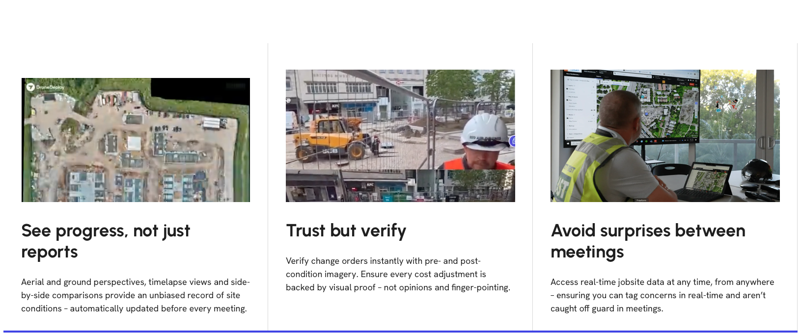
Powered by DroneDeploy’s Industry-Leading Software